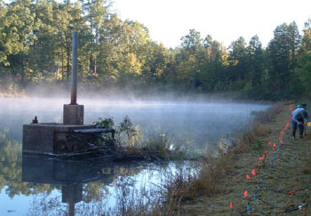
Earthen Dam and Levee Assessment
 According to the National Dam Inventory (NID, 2009), there are more than 85,000 dams in the United States. These watershed projects represent a $14,000,000,000 infrastructure, providing flood control, municipal water supply, recreational opportunity, and wildlife habitat enhancement. The failure of these dams and associated release of the impounded water can result in significant damage to crops, livestock, and possible loss of life.
Rapid assessment of the potential failures in levee and earthen dam requires advanced screening tools to delineate, classify, and prioritize compromised locations. Numerous geophysical techniques being considered for the assessment of the condition of embankment dams and levees. With increasing urbanization and critical infrastructure in flood prone areas there is a growing number of high hazard dams. Advances in low power sensors, wireless communication, and the internet makes continuous monitoring of high hazard dams a viable option.
The goal of this research is to develop, adapt and evaluate, and integrate non-invasive geophysical methods and complementary modeling efforts, in support of a comprehensive earthen dam interrogation and monitoring program.